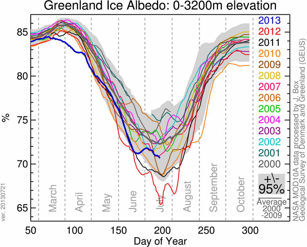
Darker snow surfaces absorb more sunlight and melt quicker. This effect is visible in Greenland. Box et al.,"Greenland ice sheet albedo feedback: thermodynamics and atmospheric drivers," The Cryosphere, v6, pp821 et seq., doi:10.5194/tc-6-821-2012 state: " Thus, intraseasonal summer albedo variability exceeds 0.50 over parts of the ice sheet where a snow layer ablates by mid-summer, exposing an impurity-rich ice surface ..." Prof. Box is now investigating soot from North American wildfires as a factor in the darkening of Greenland. At his web site meltfactor.org, he has albedo data through half of 2013:
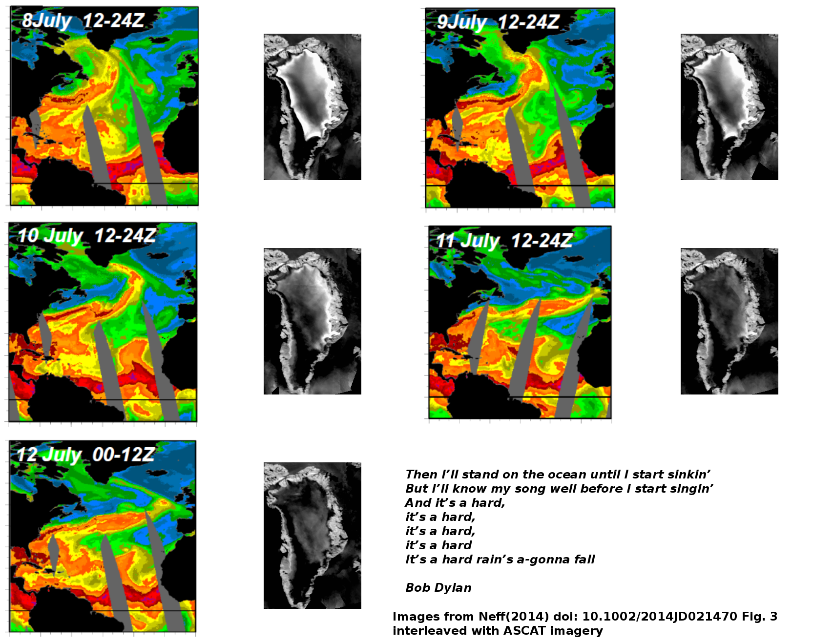
The extraordinary melt in 2012 was captured in a series of infra
red images (ASCAT) taken from space.
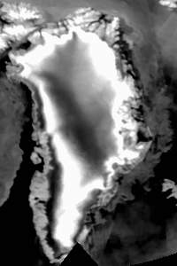
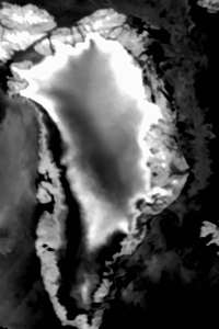
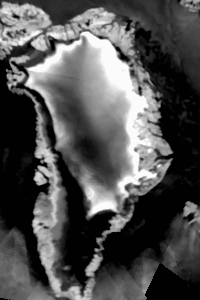
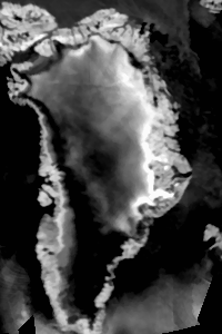
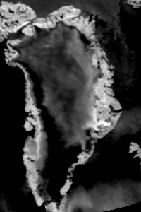
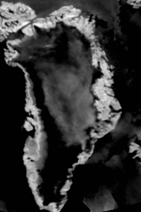
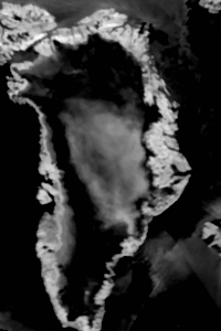
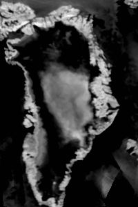
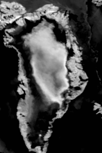
The images were taken on 29th May,18th June,9th July,10th July,
11th July,12th July,13th July,14th July,and the 18th of July.
The following animated GIF shows the sequence from the 29th
of May through the 6th of September.
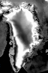
What is shown above is nothing less than the entire surface of Greenland melting. This has never been seen before.
Behold the chakra of doom. A video of the of the arctic and subarctic in infrared for 2012 may be found avi, flv or mp4. The mp4 seems to have the best detail. ImageMagick and ffmpeg are wonderful things.
Greenland surface mass balance has started to dominate glacier discharge since 2006.
Current projections of the fate of the icesheets are uncertain. Projections using linear, semi-empirical models project a range of 0.5 to 2 meters by 2100. These do not and cannot take into account nonlinear processes destabilizing the ice sheets.
The page this one supports is here
Some more posts on Greenland are linked from here and new bedrock maps here