Bamber, J.L. et al. doi:10.5194/tc-7-499-2013
For ice surface views, go here. For dual ice surface and bedrock views, go here. For contour and ice velocity maps of the Northeast, go here. For a discussion of a possible trough under Zachariae, go here. For a discussion of errors in the dataset, go here. The images below are links to larger versions. Click on the image to view the larger version.
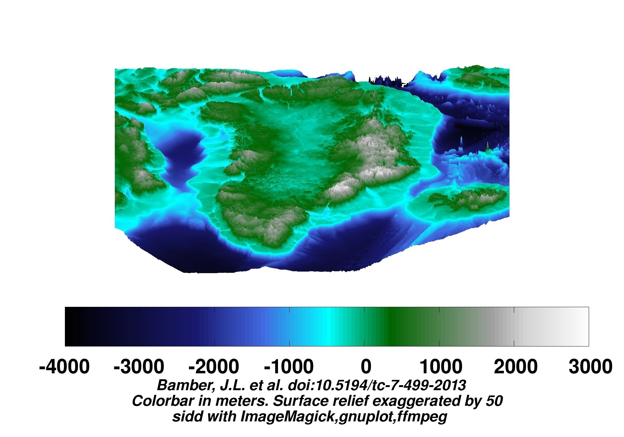
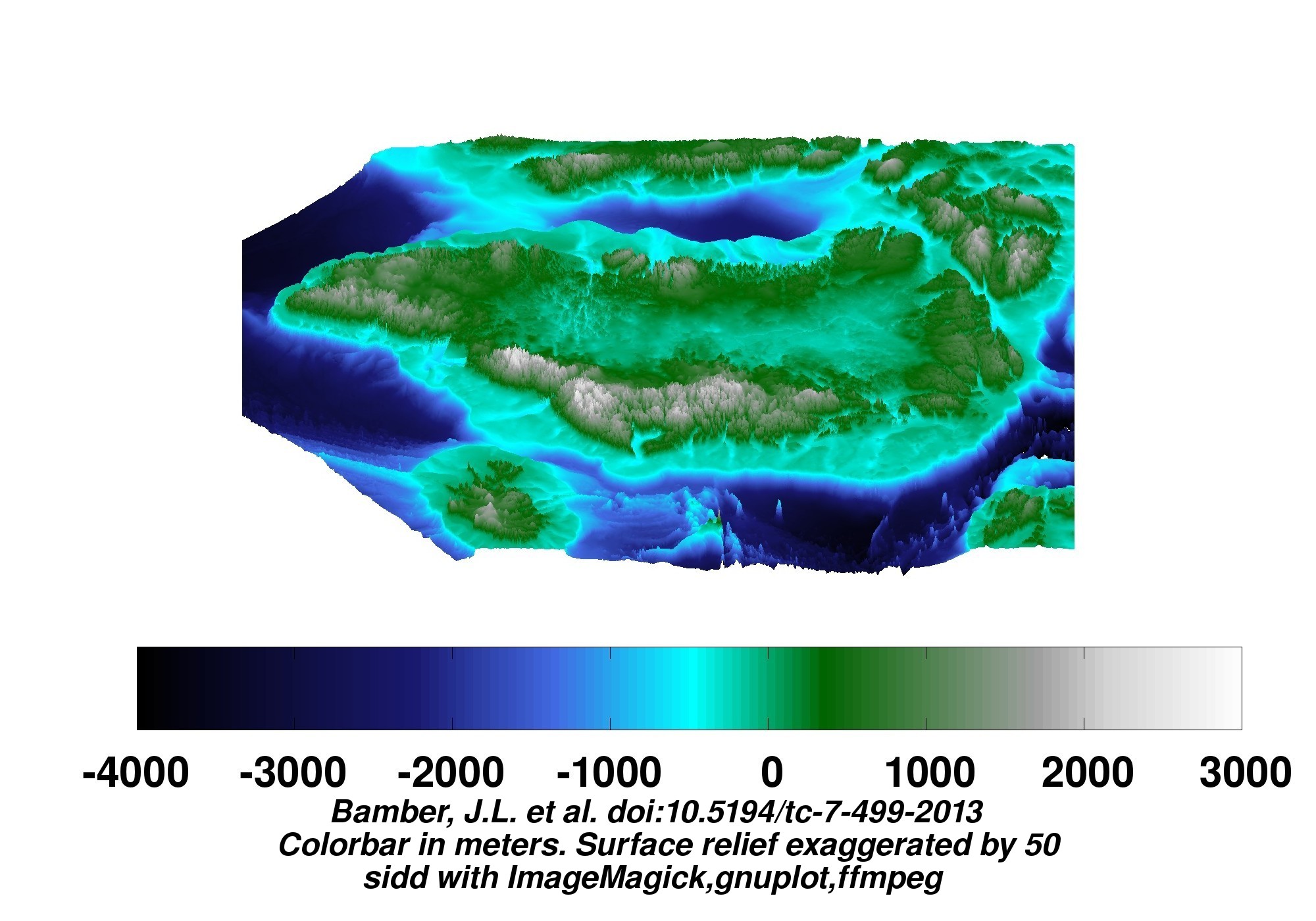
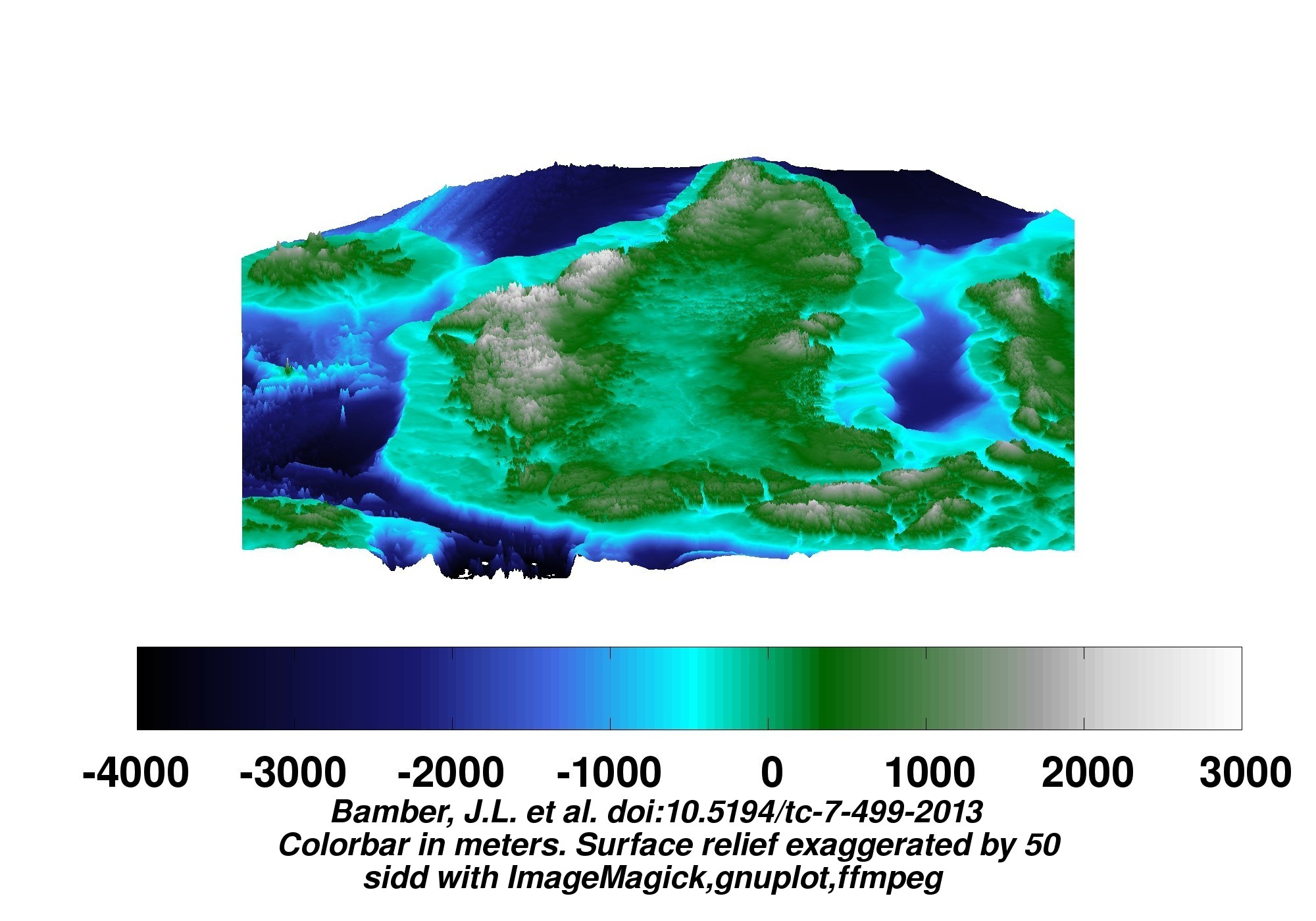
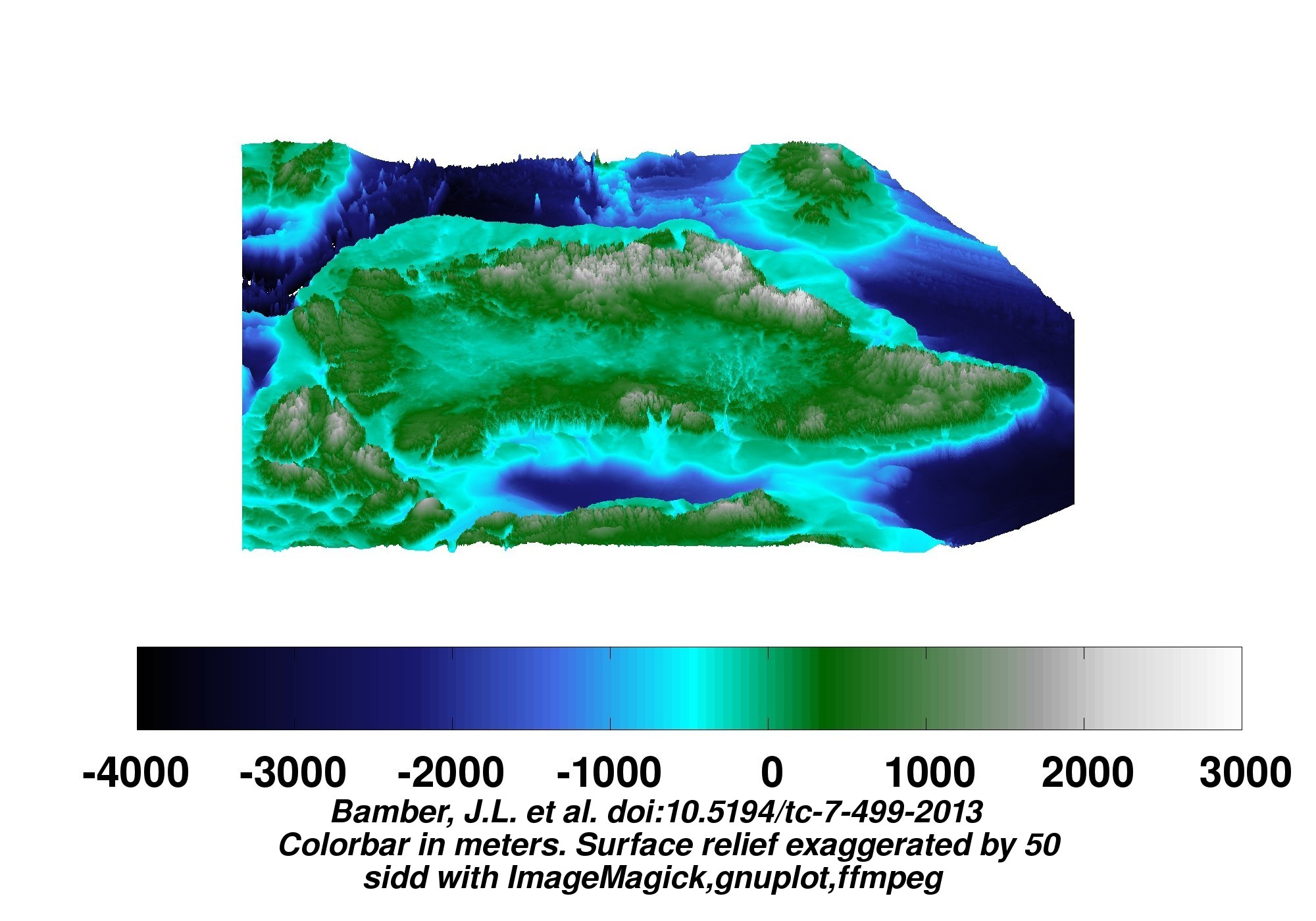
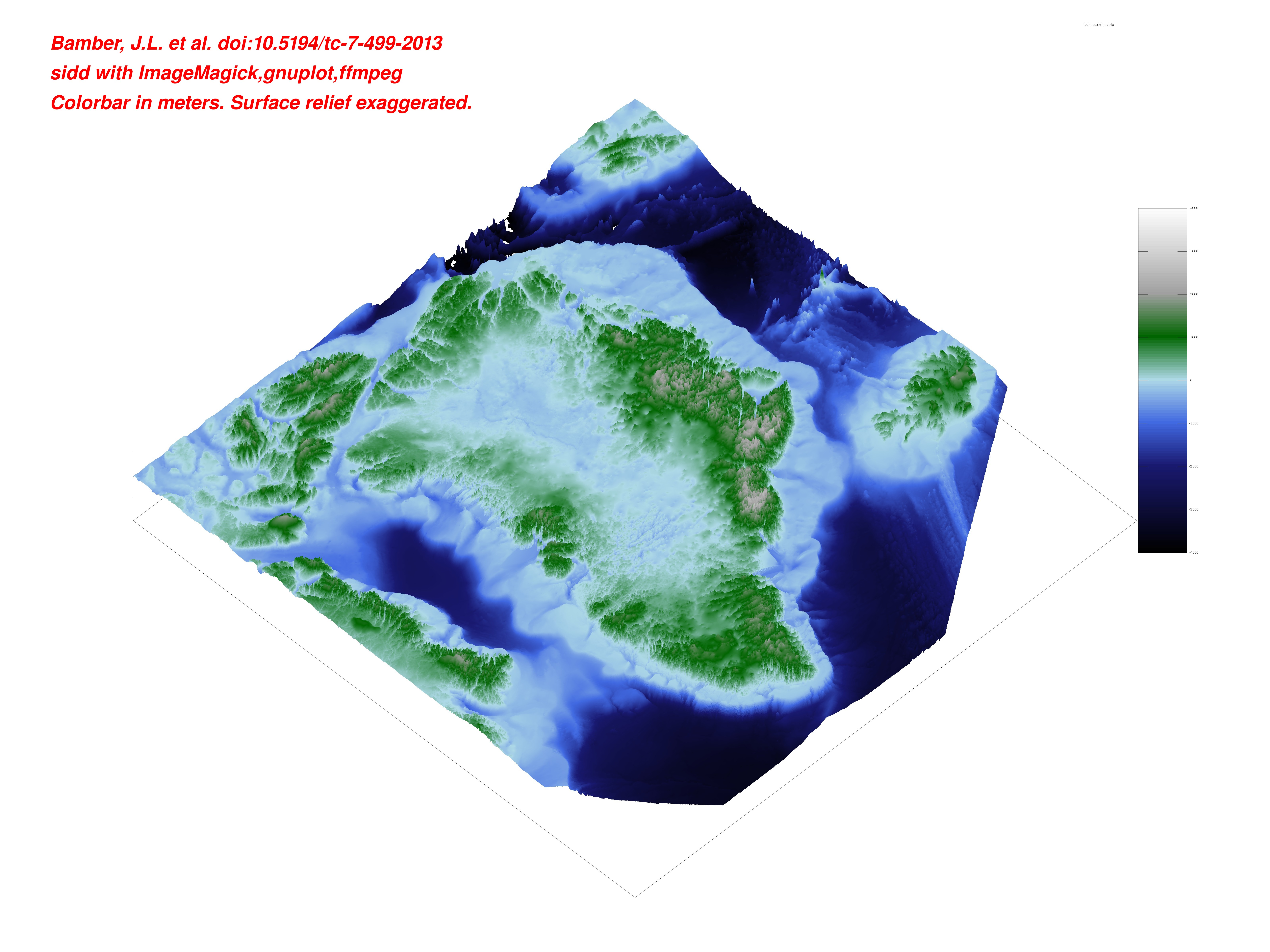
Some bedrock views follow. No isostatic rebound included. (When the ice melts, the earth beneath will rise as she is unburdened. This effect is not included in the depictions here.)
45 degree projection looking toward the four cardinal points:
A larger (2M) view is here. An MP4 movie(10M) is here.
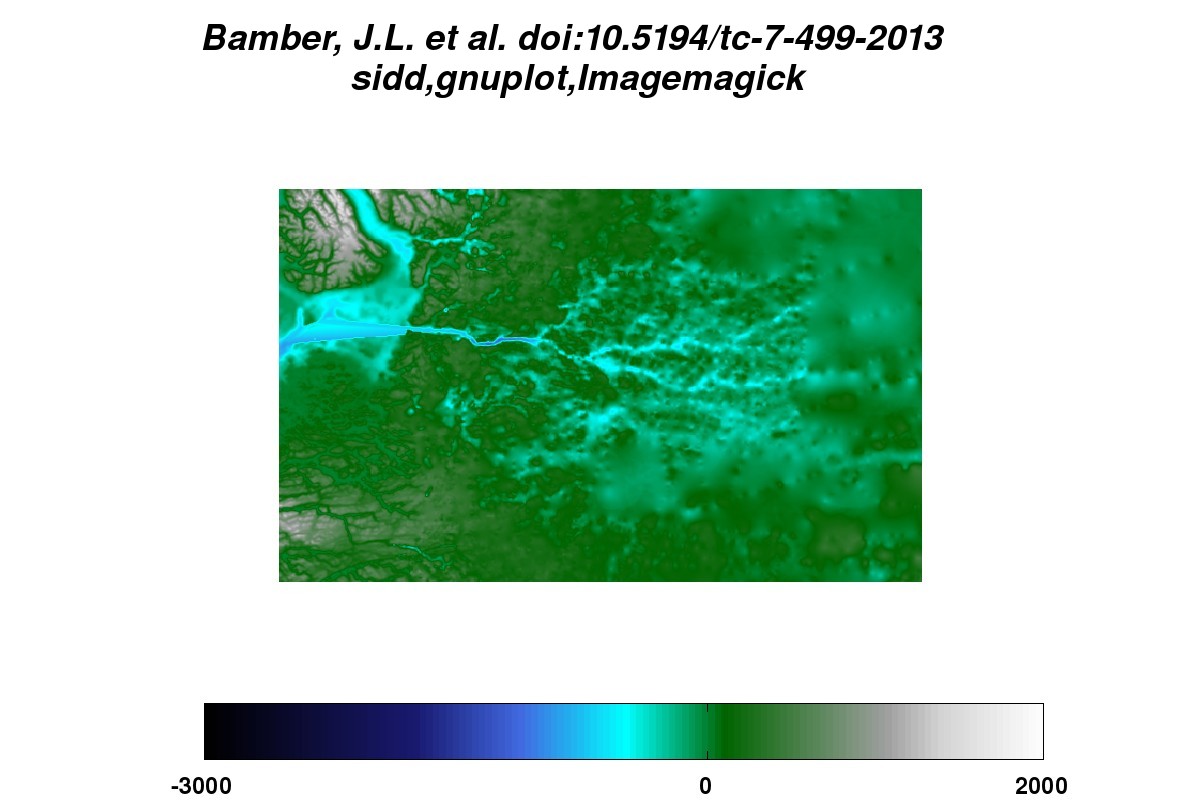
Jacobshawn detail from overhead Note the tributaries.
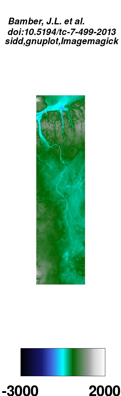
Petermann detail from overhead A long and grand canyon.
Why, it might be a green and pleasant land, indeed.
Return to Science