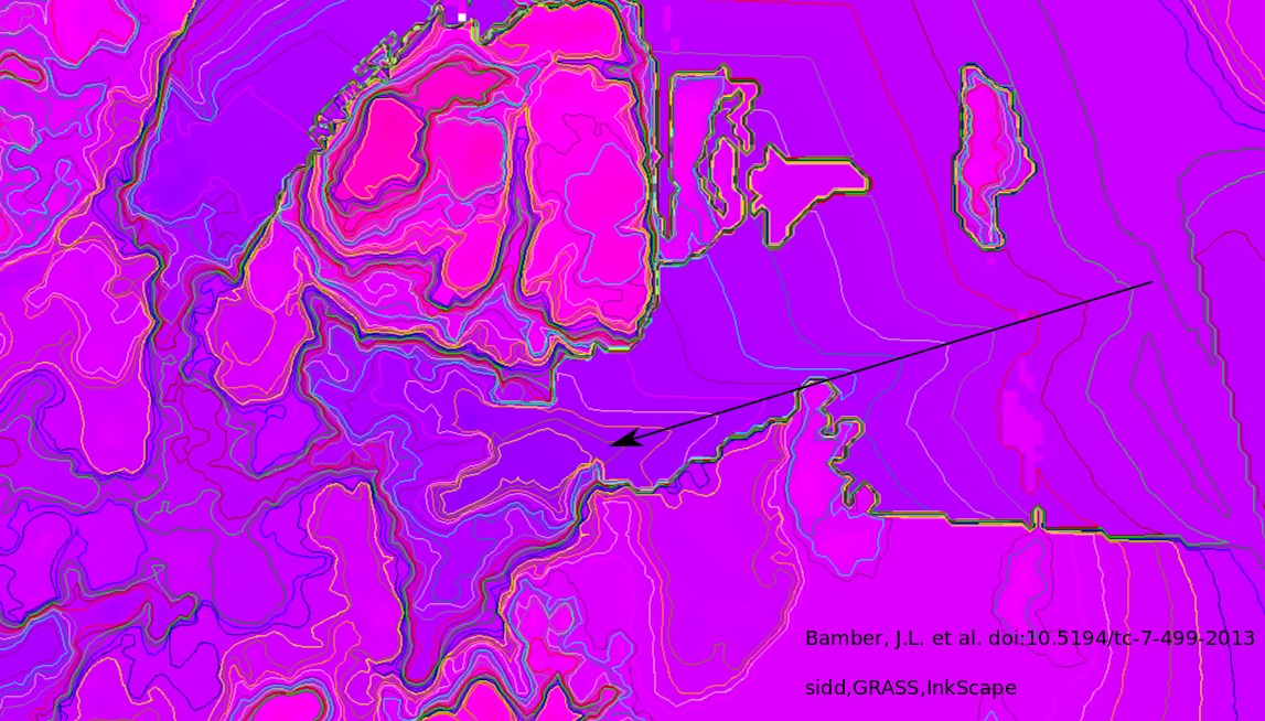
Hot water to Zachariae
The two northern mouths of NEGIS, Nioghalvfjerdsfjorden to the north of Lambert Island and Zachariae Isstrom to the south of Lambert Island, have been behaving differently. The latter iceshelf is disintegrating quicker.
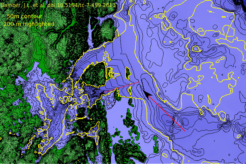
I thought to draw a parallel to West Antarctica, where it is known
that bedrock troughs shelf allow warmer
water to penetrate to the base of the ice. Using the excellent new
data set from Bamber, J.L. et al. doi:10.5194/tc-7-499-2013
I make a map of the bedrock. As in West Antarctica we see a pronounced
trough beneath Zachariae. And the bed has a bigger deep spot under it
than Nioghalvfjerdsfjorden does. I believe that trough is allowing
Atlantic Intermediate Water below the cold Polar water to reach the
base of Zachariae but not Nioghalvfjerdsfjorden (yet!)
The arrows indicate possible ingress for Atlantic Intermediate water.
In the next image it lies along the trough.
The East Greenland Current flowing south past the area is known to
have Polar water down to 150 to 200 meters. I reproduce Fig 4 from
Aagard(1968, "The East Greenland Current North of the Denmark Strait:
Part 1", Arctic, v21)
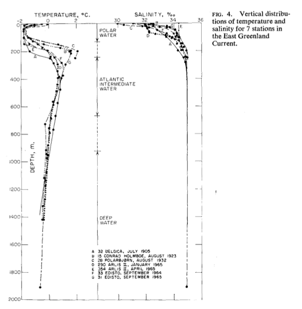
I quote from the paper: "The Polar Water extends from the surface down to a mean depth somewhat greater than 150 m. The temperature varies about 0C ..." "The Atlantic Intermediate Water underlies the Polar Water extending down to approximately 800m. The temperature remains greater than 0C, and a temperature maximum, which lies between 200 and 400 m is present throughout the year."
This is an old paper, perhaps Prof. Muenchow will have new data on those water masses.
Here is a newer (2001) paper, Fahrbach et al. Polar Research 20(2), 217-224
of measurements along a transect very close to 79N (remember 79N is
NioghalvfjerdsFjorden, eastward from 16 W which is just off Norske Oer
the northern end of the chain of islands off Lambert Island. The next
gigure is Fig 3a) from that paper, note the lack of Atlantic Intermediate
water on the continental shelf.
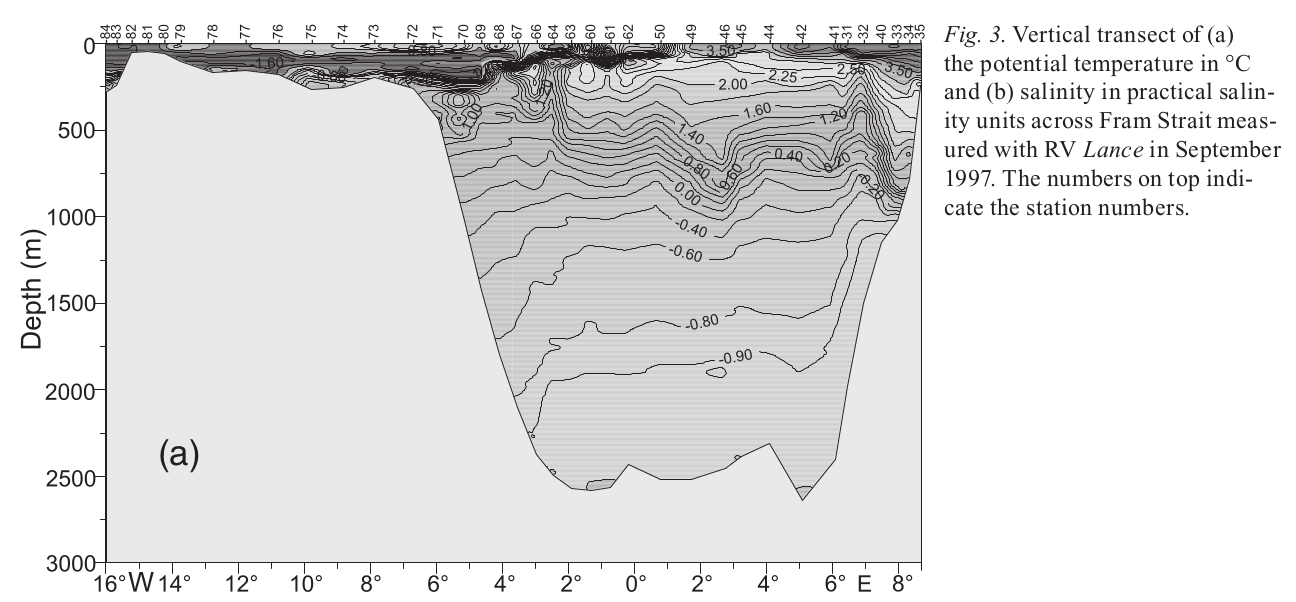
So 200 m is a good depth to watch
Some more pictures:The first a larger view, 200m isotherm higlighted.
No way in for warm water from the northeast, but perhaps from the southeast.
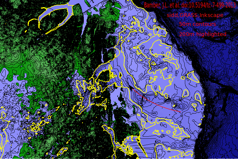
And a closer look: I have included path of ingress of warm water
down the trough.
Note the ridge coming into
the top corner of Lambert Island, providing additional barrier to
Atlantic Intermediate water from the southeast getting under
Nioghalvfjerdsfjorden.
Return to Greenland 2013 Return to Science