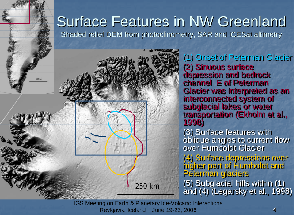
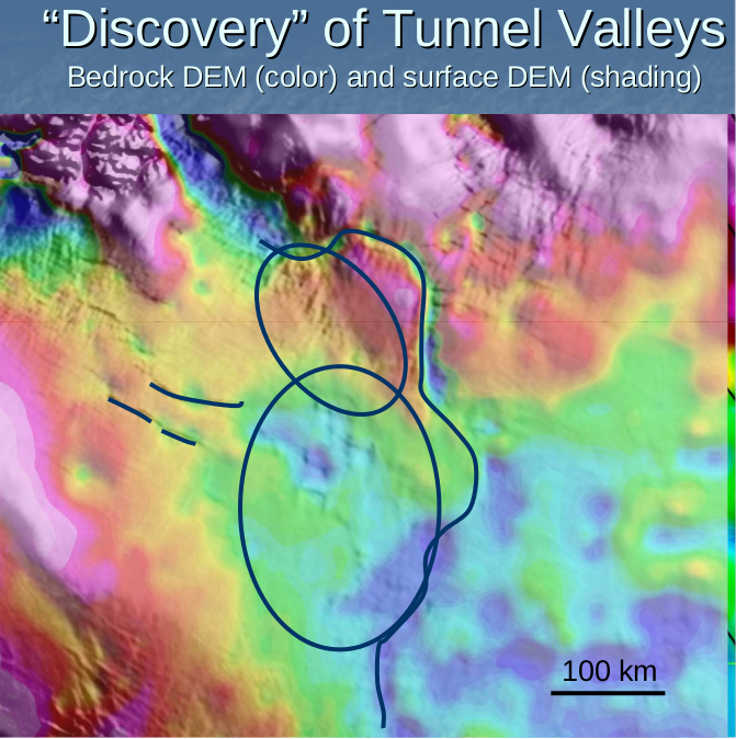
Bedrock beneath greenland affects the surface flow, as seen in the slides below from Csatho's presentation in 2006, using the Bamber(2001) data set.
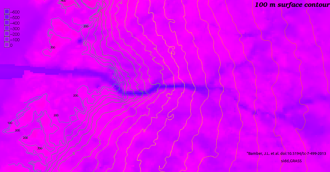
The next three images are from the Bamber(2013) data set, with 100m surface contours superposed on color coded bedrock image. Note how the surface contours have kinks exactly where they cross the deep channels in the bedrock. Since we can see the surface much more clearly than the bedrock, perhaps it may be possible to deduce bedrock features from the surface topo, as Csatho was alluding to. It's quite amazing tthat the ice surface feels the shae of bedrock a kilometer below.
A close up of Nioghalvfjerdsfjorden and Zachariae Isstrom
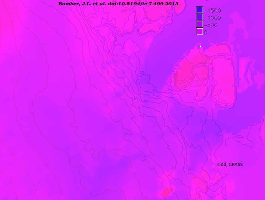
A close up of Peterman and Humboldt
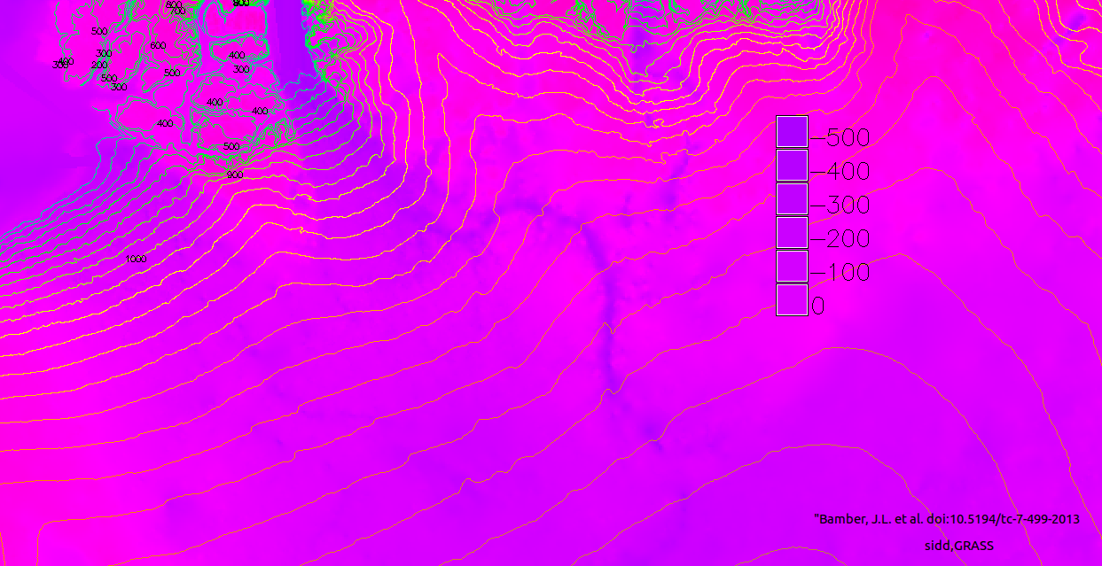
The same for Jacobshawn
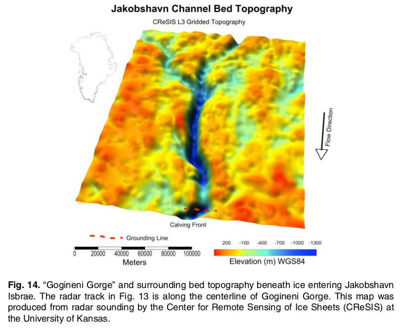
And I see Hughes(2014) doi:10.5194/tcd-8-2043-2014 has a beautiful view of "Gogineni Gorge" under Jacoshawn
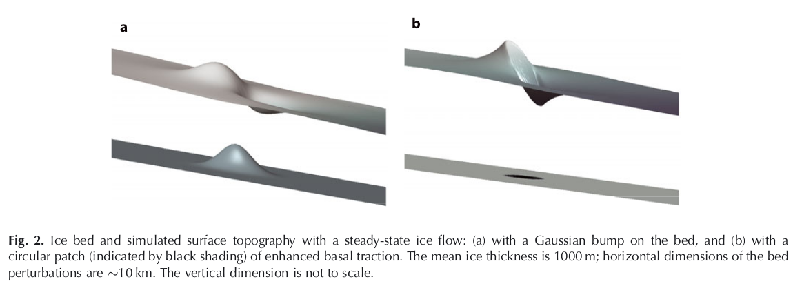
For an idea of how surface is affected by bedrock see Sergienko(2013) doi: 10.3189/2013JoG12J040
Here is Fig 2.
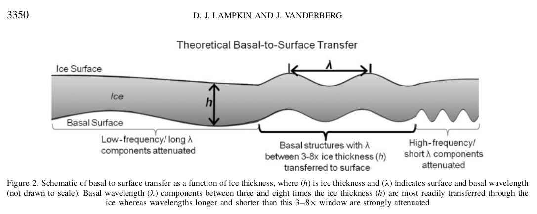
Other interesting papers are a pair by Lampkin in 2011 doi:10.1029/2010JF001725 and DOI: 10.1002/hyp.8170
The next image is from the second paper:
Return to Greenland 2013
Return to Greenland 2013 velocity, bedrock and surface