Posts Tagged ‘weather’
Monday, January 23rd, 2012
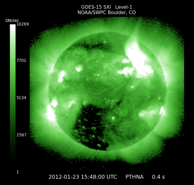
As the strongest Solar Radiation Storm (S3) since May, 2005 continues, the associated Earthward-directed Coronal Mass Ejection is expected to arrive about 1400 UT (9am EST) Jan 24. SWPC has issued a Geomagnetic Storm Watch with G2 level storming likely and G3 level storming possible, with the storm continuing into Wednesday, Jan 25. All of this activity is related to a moderate (R2) Radio Blackout x-ray flare that erupted Sunday night (11pm EST).

Geomagnetic Storm Photo of the Sun
NOAA Updates
Posted in Energy, Environment, Science, weather | Tags: Earth, eruption, Geomagnetic Storm, radio blackout, solar radiation, storm, Sun, weather, x-ray | Comments Off
Tuesday, November 29th, 2011
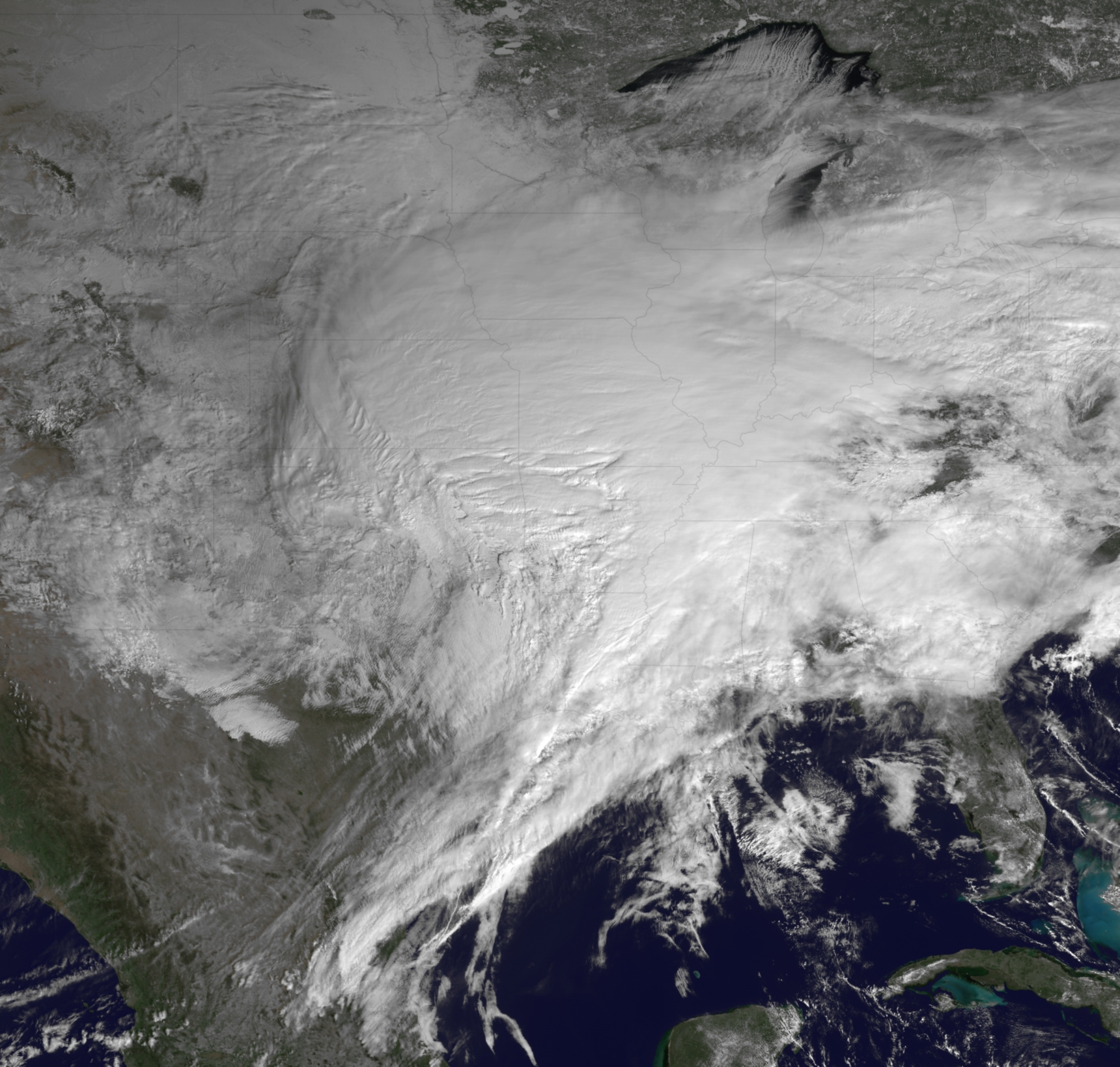
The large storm in the eastern U.S. is visible in the satellite image below, taken by GOES East at 1715Z (12:15 EST) today.
The storm system continues to bring significant rainfall to Indiana and Michigan, where Flood Warnings and Advisories are in effect. The bulk of the precipitation has ended in Kentucky and southern Indiana, but several Flood Warnings and advisories continue. Central Kentucky and southern Indiana have received 2.5 to 5 inches of rainfall over the past 2 days. Additional rainfall amounts of 1 to 2 inches are possible in northern Indiana, northwest Ohio, and central and eastern lower Michigan before changing over to snow late this afternoon and evening for the first significant snowfall of the season. Winter Storm Watches and Warnings have been posted for northern Indiana, northwest Ohio, and central and southeast lower Michigan, where 4 to 8 inches of snow will be possible, with locally higher amounts possible if rain changes to snow earlier than expected.

The large storm in the eastern U.S. is visible in the satellite image below, tak
en by GOES East at 1715Z (12:15 EST) today.
The storm system continues to bring significant rainfall to Indiana and Michigan, where Flood Warnings and Advisories are in effect. The bulk of the precipitation has ended in Kentucky and southern Indiana, but several Flood Warnings and advisories continue. Central Kentucky and southern Indiana have received 2.5 to 5 inches of rainfall over the past 2 days. Additional rainfall amounts of 1 to 2 inches are possible in northern Indiana, northwest Ohio, and central and eastern lower Michigan before changing over to snow late this afternoon and evening for the first significant snowfall of the season. Winter Storm Watches and Warnings have been posted for northern Indiana, northwest Ohio, and central and southeast lower Michigan, where 4 to 8 inches of snow will be possible, with locally higher amounts possible if rain changes to snow earlier than expected.
Get the latest forecasts, watches and warnings from your local NWS Weather Forecast Office at http://www.weather.gov/.
Latest Storm Summary from the NWS Hydrometeorological Prediction Center:
http://www.hpc.ncep.noaa.gov/discussions/nfdscc3.html
High-Res version of image from NOAA’s Environmental Visualization Lab:
http://www.nnvl.noaa.gov/images/high_resolution/900_20111129-eastcoast.jpg
Posted in Uncategorized | Tags: Eastern, flooding, floods, rain, storms, USA, weather | Comments Off
Saturday, August 27th, 2011
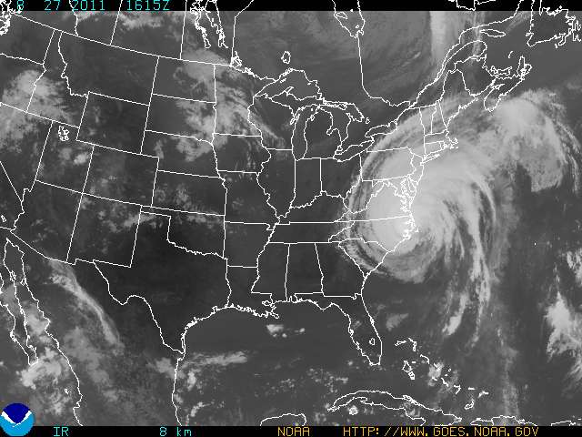
Hurricane Irene
Tropical Storm Conditions Spreading Northward Along Delmarva Coast
Published: Sat, 27 Aug 2011 10:58:54 EDT
At 11:00 a.m. EDT, the center of Hurricane Irene was located near latitude 35.2 north, longitude 76.4 west, or about 100 miles southwest of Cape Hatteras, N.C. Irene is moving toward the north-northeast near 15 mph and this general motion is expected to continue for the next 24 hours. The center of Irene is forecast to move across northeastern North Carolina this afternoon before moving near or over the Mid-Atlantic coast tonight and over southern New England on Sunday. Maximum sustained winds remain near 85 mph, with higher gusts. Irene is a Category One hurricane. Slight weakening is forecast as Irene crosses eastern North Carolina, but Irene is forecast to remain near hurricane strength as it moves near or over the Mid-Atlantic states and approaches New England. For storm information specific to your area in the U.S., please monitor products issued by your local NWS forecast office.
from noaa.gov
Posted in Uncategorized | Tags: 2011, alert, August 27, Hurricane, Irene, new jersey, Pennsylvania, season, weather | 1 Comment »
Tuesday, February 1st, 2011
“the GOES-13 satellite, captures the massive winter storm currently affecting much of the United States” — National Oceanic and Atmospheric Administration (NOAA)

Big Storm USA
Posted in Science, weather | Tags: 1, 2011, big, climage change, Febuary, global warming, storm, volatie, warming, weather, winter | Comments Off
