Fires In Nepal
Saturday, April 28th, 2012EARTH –
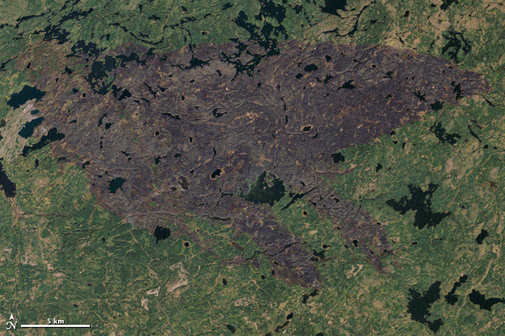
Numerous forest fires were burning throughout Nepal when the Moderate Resolution Imaging Spectroradiometer (MODIS) instrument on NASA’s Aqua satellite captured this image of the Siwalik Hills on April 24, 2012.
Nepalese officials say they have counted at least 225 fires burning; the largest has destroyed more than 600 hectares (1,480) acres of forest. Officials say the fires have been caused by a long dry spell, windy weather, and discarded cigarettes. There were 1,857 active fires last year, a relatively small number compared to the 4,217 that occurred in 2009, an exceptionally dry year.
“This might be the peak time for fire incidents for this season. However, the rise in the mercury might give rise to more devastating forest fires across the country,” Sundar Prasad Sharma, the coordinator at the UN International Strategy for Disaster Reduction-South Asia Wildland Fire Network, told the Kathmandu Post.
Nepalese officials are currently testing a pilot version of a new wildfire monitoring system based on data from MODIS. Interactive maps showing fire locations are available here.
-
References
- Parajuli, K. (2012, April 27) Nepal, the Himalayan Forests are Burning. AsiaNews Accessed April 27, 2012.
- BBC. (2012, April 26) More Than 220 Forest Fires Spread Across Nepal. Accessed April 27, 2012.
- The Kathmandu Post. (2012, April 24) Forest Fires Raging Across Country. Accessed April 27, 2012.
NASA image by Jeff Schmaltz, LANCE MODIS Rapid Response. Caption by Adam Voiland.
- Instrument:
- Aqua – MODIS